The Quarry Entry: Gaussian Data Visualization & LiDAR Scanning
Executing a High-Precision 3D Workflow in Yeongwol's Harsh Quarry Terrain
Hello from 75mm Studio.
Today, we're sharing our process of capturing and visualizing Gaussian Splatting data for the exterior of a quarry in Yeongwol, Gangwon-do.
To build a high-quality 3D asset in a rugged natural environment, we utilized our standard workflow: seamlessly integrating fixed, high-precision terrestrial LiDAR, ground-level photography, and aerial drone photogrammetry to produce an output of overwhelming quality. From a single site, our pipeline derives survey-grade PCD (Point Cloud Data), precise geometry, high-quality textured meshes, and Gaussian Splatting—multi-purpose data ready for a wide range of applications, all from one unified workflow.
1. A Race Against Time: Securing Precision Data Before the Shadows
The most significant variable in outdoor scanning is "natural light."
On the day of the shoot, the sky was completely clear. While overcast weather provides the diffused light ideal for capturing textures, a bright, sunny day means direct sunlight creates harsh shadows against the mountainside and quarry structures. We had to move quickly and complete the scanning process before the sun's trajectory cast deep shadows over the interior of our scanning area, ensuring we could extract the highest quality textures.
Notably, while LiDAR scanning itself is unaffected by light conditions, the color images captured simultaneously—which serve as the texture source—are extremely sensitive to lighting. Areas covered by deep shadows suffer a dramatic loss in texture quality. This required a strategic approach: constantly monitoring the sun's altitude and azimuth in real-time to adjust the scanning order on the fly. Ultimately, we successfully completed all texture photography just before shadows encroached upon our target area.
2. Navigating Extreme Terrain
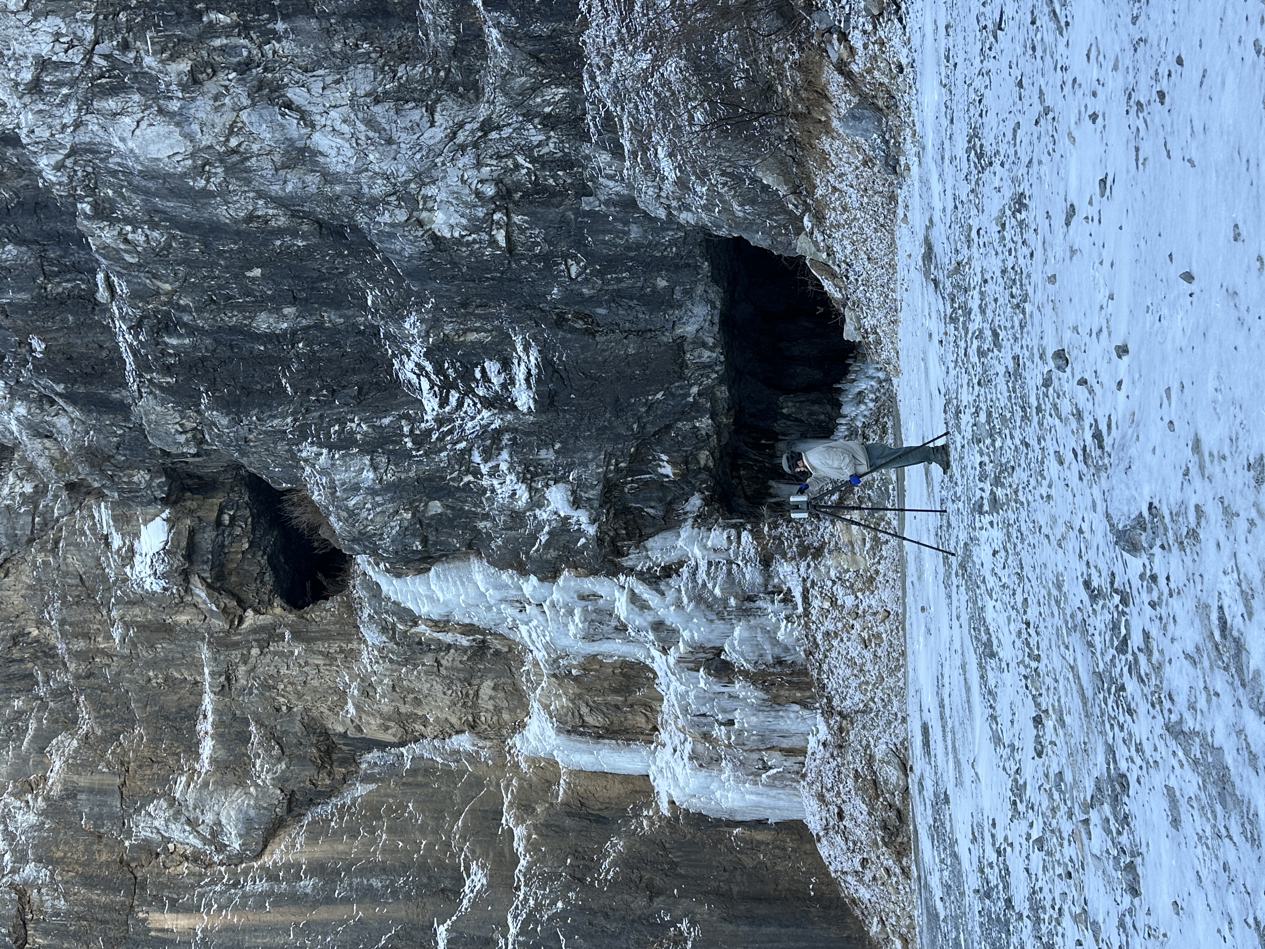
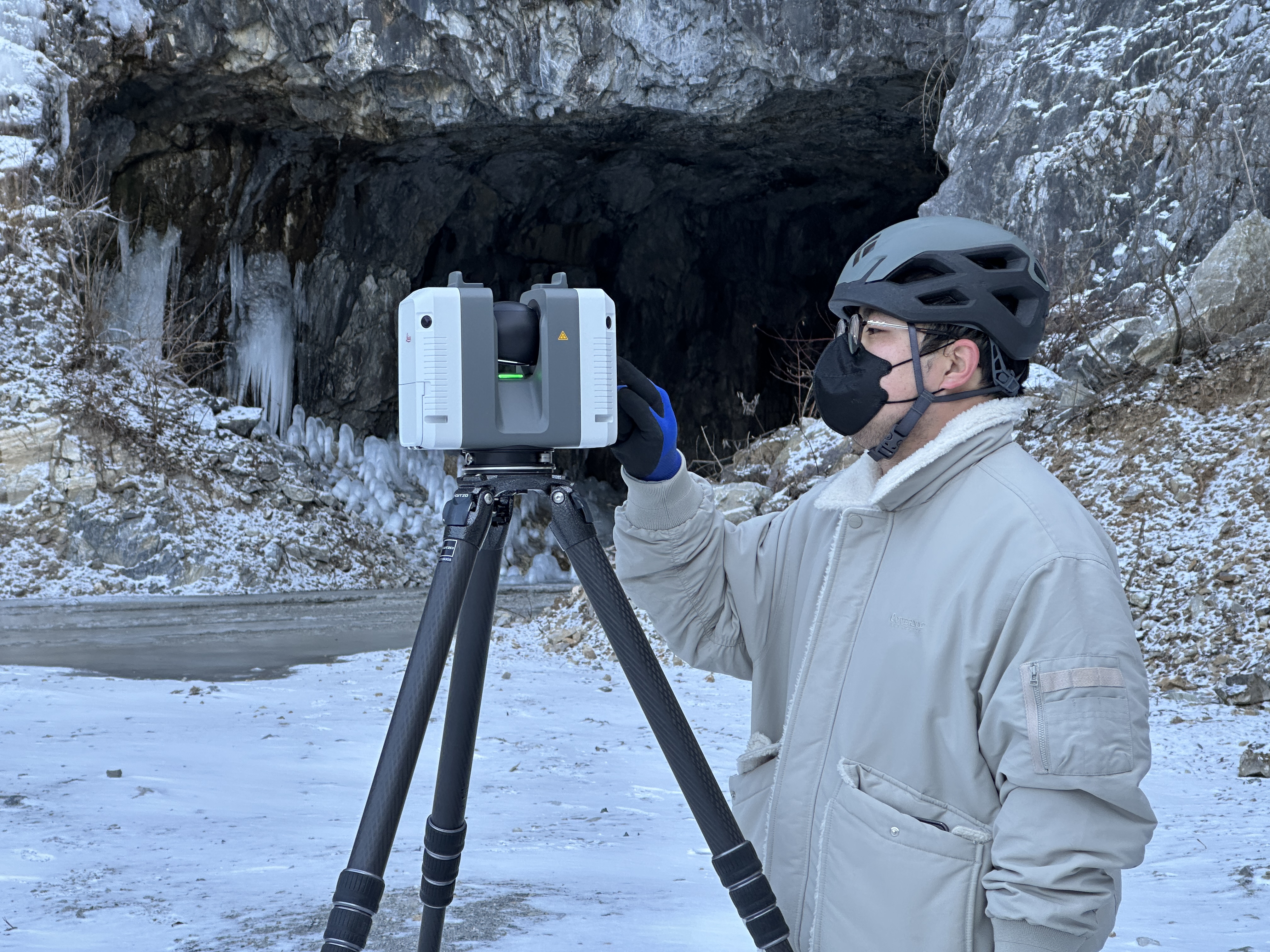
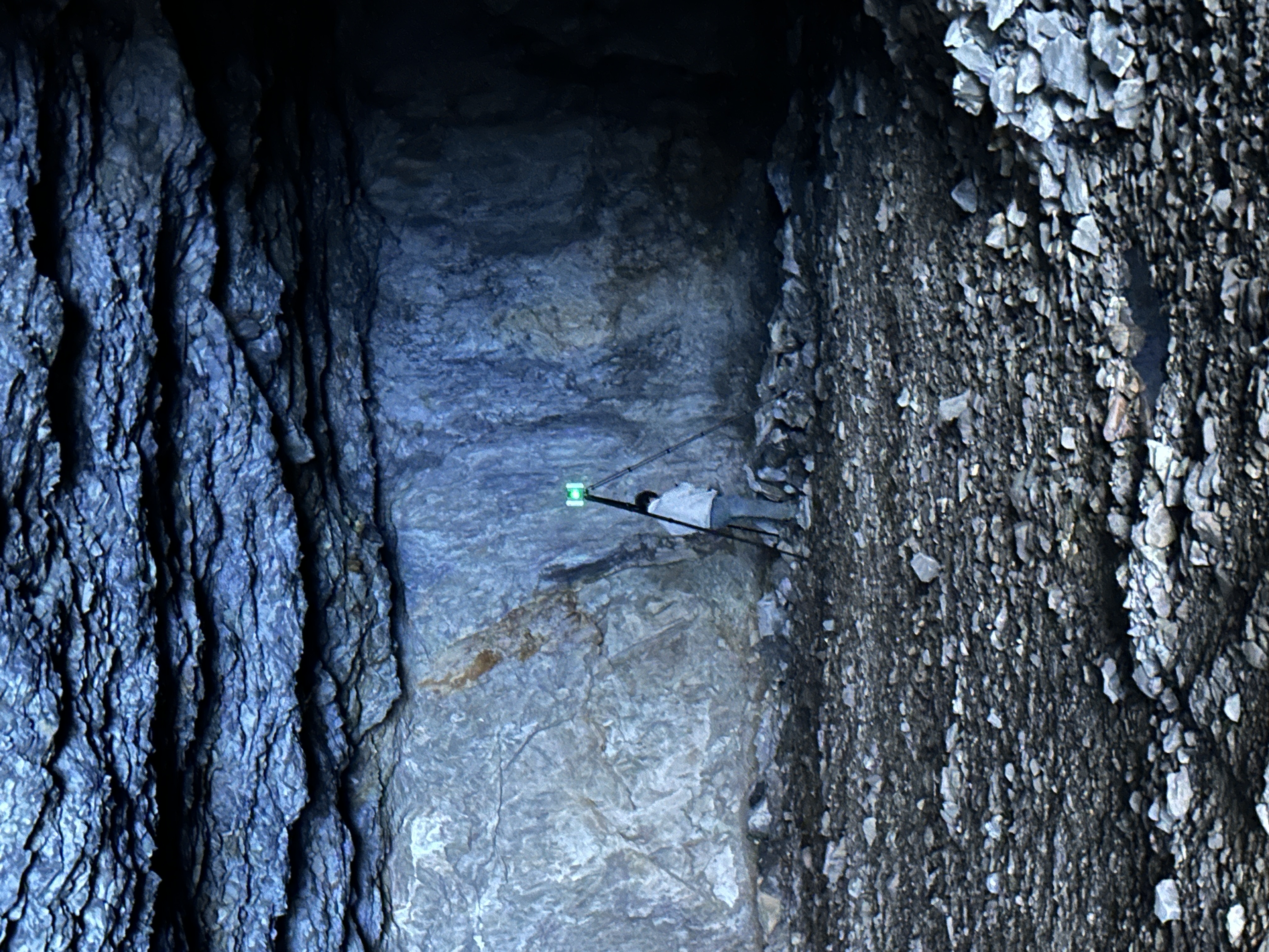
The path into the quarry was covered with jagged rocks and severely uneven ground, making vehicle access impossible. With most sections impassable for vehicles carrying large equipment, our team had to manually transport all heavy, high-precision LiDAR scanners, tripods, target spheres, cameras, and batteries to each scan point on foot.
In such an environment, the physical safety of the equipment is important, but crew safety is paramount. We strictly followed safety protocols throughout every process—from mounting tripods on unstable rock surfaces to maneuvering equipment through narrow passages. At the same time, we methodically followed our pre-planned scan schedule to guarantee complete coverage without any data blind spots.
3. Drone Flights in Gale-Force Winds and Multi-Data Integration
To capture the expansive topography at the upper levels of the quarry and any blind spots missed from the ground, we concurrently utilized drone-based photogrammetry. Aerial data plays a decisive role in supplementing what terrestrial LiDAR cannot cover—namely the tops of vertical cliff faces and the broader topographic context that can only be perceived from elevation.
However, the quarry's specific open topography channeled extreme winds that threatened the stability of the drone. Valley winds in the mountainous terrain combined with updrafts along the quarry's cliff faces created complex turbulence, causing the aircraft to shake violently at unpredictable intervals. Given the high risk of crashes or collisions, our highly skilled operators exercised extreme caution to control the UAVs throughout every flight pass.
The resulting aerial images were then faultlessly integrated with the terrestrial LiDAR point clouds and high-resolution ground photos to generate flawless 3D spatial data.
One Site, Multiple Data Derivatives
The core value of 75mm Studio's workflow lies in the fact that a single field operation yields data applicable across a wide range of uses.
- Survey-Grade PCD (Point Cloud Data): Millions of points captured directly by LiDAR constitute the raw data immediately usable for architecture, civil engineering, surveying, and other measurement-based applications.
- Precise Geometry: Meshes reconstructed from PCD accurately reflect physical structures and forms. This data powers structural analysis, simulation, and design review.
- High-Quality Textured Mapping: High-resolution images captured on-site are precisely mapped onto the geometry, producing visual data virtually indistinguishable from the real scene.
- Gaussian Splatting: Applying the latest 3D rendering technology, we deliver an interactive visualization that can be explored in real-time directly in a web browser.
We don't simply create a single 3D model. From one site, we build a multi-purpose data pipeline spanning surveying, design, visualization, and presentation.
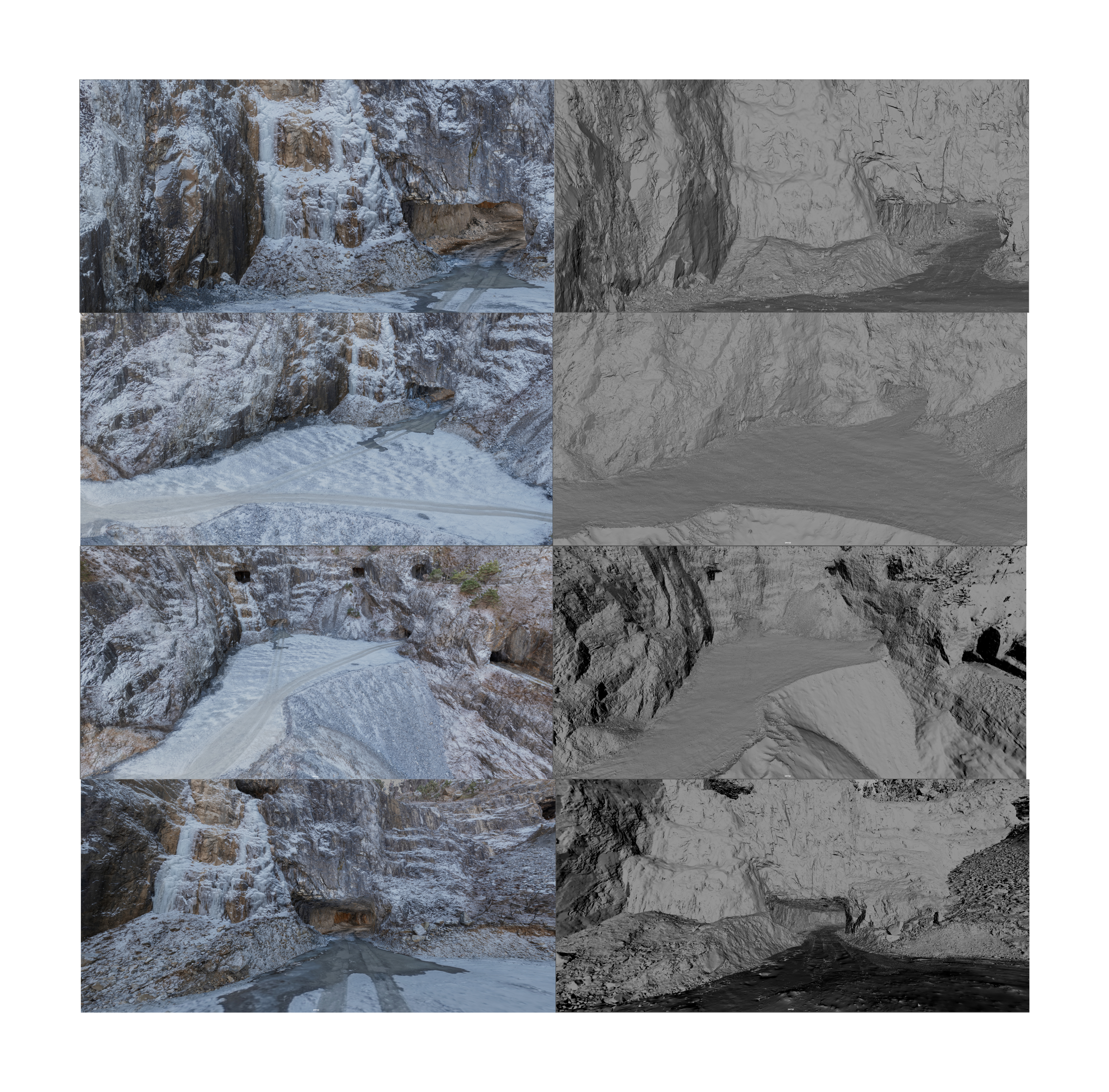
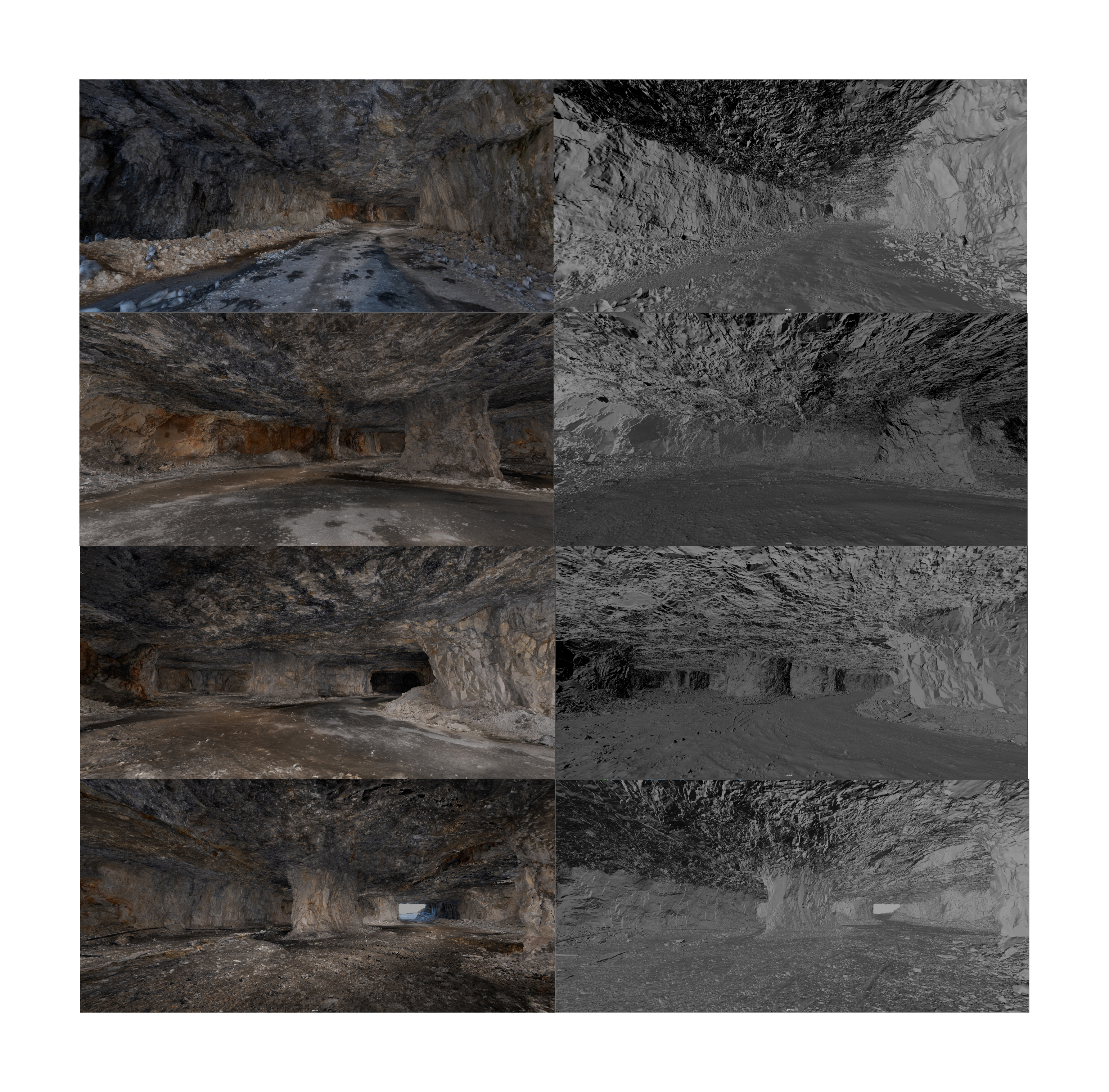
Results: Precise Geometry Meets Photorealistic Textures
The images below demonstrate the completeness of our final data. On the left is the final output mapped with high-quality textures, and on the right is the 'Geometry Only' view that highlights the immense precision of the underlying structure.
Exterior Scan Results
Interior Scan Results
The Quarry Entry Gaussian Data
Experience the optimized Gaussian Splatting data of the Yeongwol Quarry, crafted through 75mm Studio's workflow. Explore the 3D space in real-time directly in your web browser.
Technical Details & FAQ
What is LiDAR scanning and how is it used in VFX?
How does 75mm Studio process massive Point Cloud data?
What is the primary difference between Photogrammetry and LiDAR?
Why is 3D Gaussian Splatting revolutionary for spatial archiving?
Interested in this technology? Contact Us